After Nivar, TN likely to receive heavy rains
November 26, 2020 20:24
Slammed by the severe cyclonic storm Nivar early Thursday, Tamil Nadu is likely to receive another spell of very heavy rainfall as a fresh low pressure area is expected to form in the Bay of Bengal from November 29 onwards, the India Meteorological Department (IMD) said.
IMD Director General Mrutunjay Mohapatra said the low pressure area likely to form on November 29 may bring very heavy rains over Tamil Nadu.
He, however, said it needs to be seen whether the low pressure area will intensify into a cyclone.
A low pressure area is the first stage of formation of a cyclone.
"We are closely monitoring it (the low pressure area)," Mohapatra said.
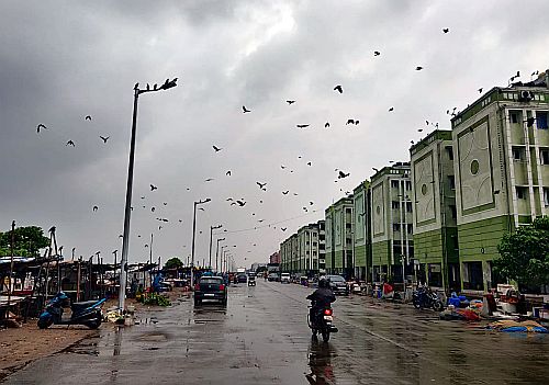
Cyclone Nivar, which hit the Tamil Nadu coast as a 'very severe cyclonic storm' in the early hours of Thursday, has brought heavy rains over the state, especially in its northern parts.
Under its influence, Puducherry received 30 cm rainfall, the highest among the affected regions, followed by Cuddalore in Tamil Nadu with 27 cm precipitation. Nagapattinam recorded 6.3 cm rainfall, Karaikal 9.6 cm and Chennai 11.3 cm.
The IMD has also issued an amber-coloured warning (second most dangerous in the list) for coastal Andhra Pradesh on November 27.
The Bay of Bengal witnesses formation of cyclones, especially during October-December months.
The period also brings the Northeast Monsoon over Tamil Nadu, Puducherry, parts of Kerela, Andhra Pradesh and Karnataka. -- PTI
TOP STORIES


 © 2024 Rediff.com - Investor Information - Advertise with us - Disclaimer - Privacy Policy - Feedback - About us - Terms of use - Grievances